
The profiles listed in this Register have been documented from the stories and photos contributed by custodians and others who willingly shared information. Readers who have additional information about the history of any Couta Boat are invited to forward it to couta_profile@coutaboat.com.au so that it can be added to the Register.

Higgs Brothers, Geelong, Victoria.
Planking: NZ Kauri
Ribs: Spotted Gum
Deck: Celery Top Pine
Custodian: Cyril Norton; 1942 – Mid 1960s
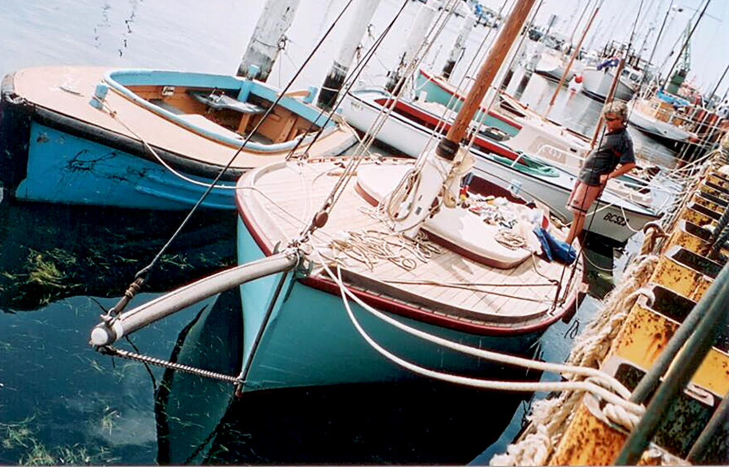
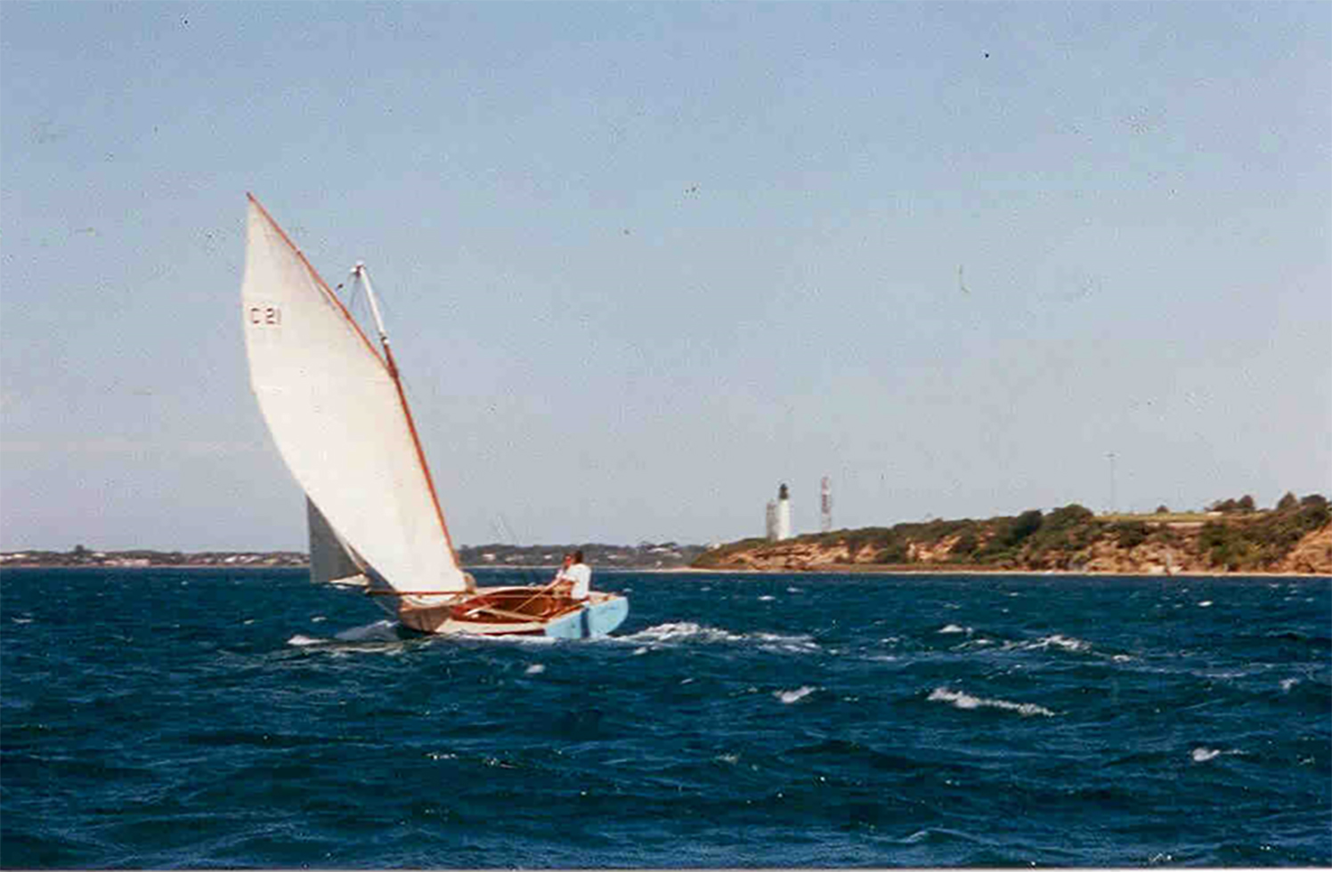
Pelican is a 24 foot Couta Boat built by Higgs of Geelong in Victoria. She was constructed in 1942 for fisherman Cyril Norton. Soon after her build she was taken to Lorne on the south coast of Victoria from where she fished in Bass Strait. Her original name was the Golden Hind.
Cyril owned her for over 20 years. In this time she was modified to suit conditions for fishing in the open sea: two upper planks were added to the hull and the deck level was raised to increase the freeboard. There is a large framed photograph of Cyril landing a barracouta whilst fishing from Golden Hind, displayed on the walls of the Lorne Historical Museum. However, nothing more was documented about the boat, and whether she was still used as a fishing vessel. It was not until the mid 1990s that Golden Hind was located, at Mornington on Port Phillip.
Custodians: Ken Telford; 1995 – 1996
Custodian: Charlie (Johanno) Johnston; 1996 2000
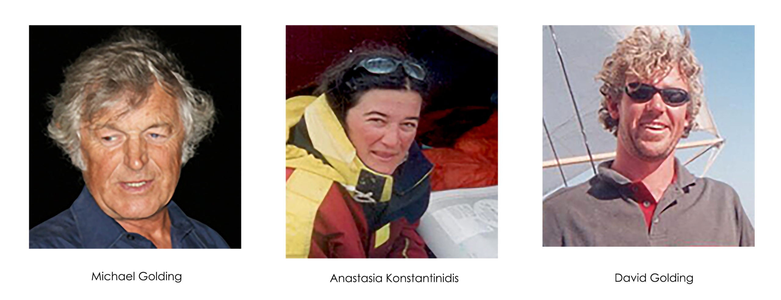
In 1995, Ken Telford from Mornington became Golden Hind’s new custodian. A year later, Charlie Johnston, a shipwright from Raymond Island in the Gippsland Lakes, purchased the ‘hulk’. By this stage, the boat had deteriorated and had rotted ribs and a missing deck. Charlie transported the hull to a shed in Victoria Dock in Melbourne, where he was working with others to restore the famous classic yacht Waitangi. His intention was to restore the Golden Hind in his spare time. However, plans changed and he sold the hull to David Golding and Anastasia Konstantinidis who were also working on Waitangi.
Custodians: David Golding and Anastasia Konstantinidis; 2000 – Present
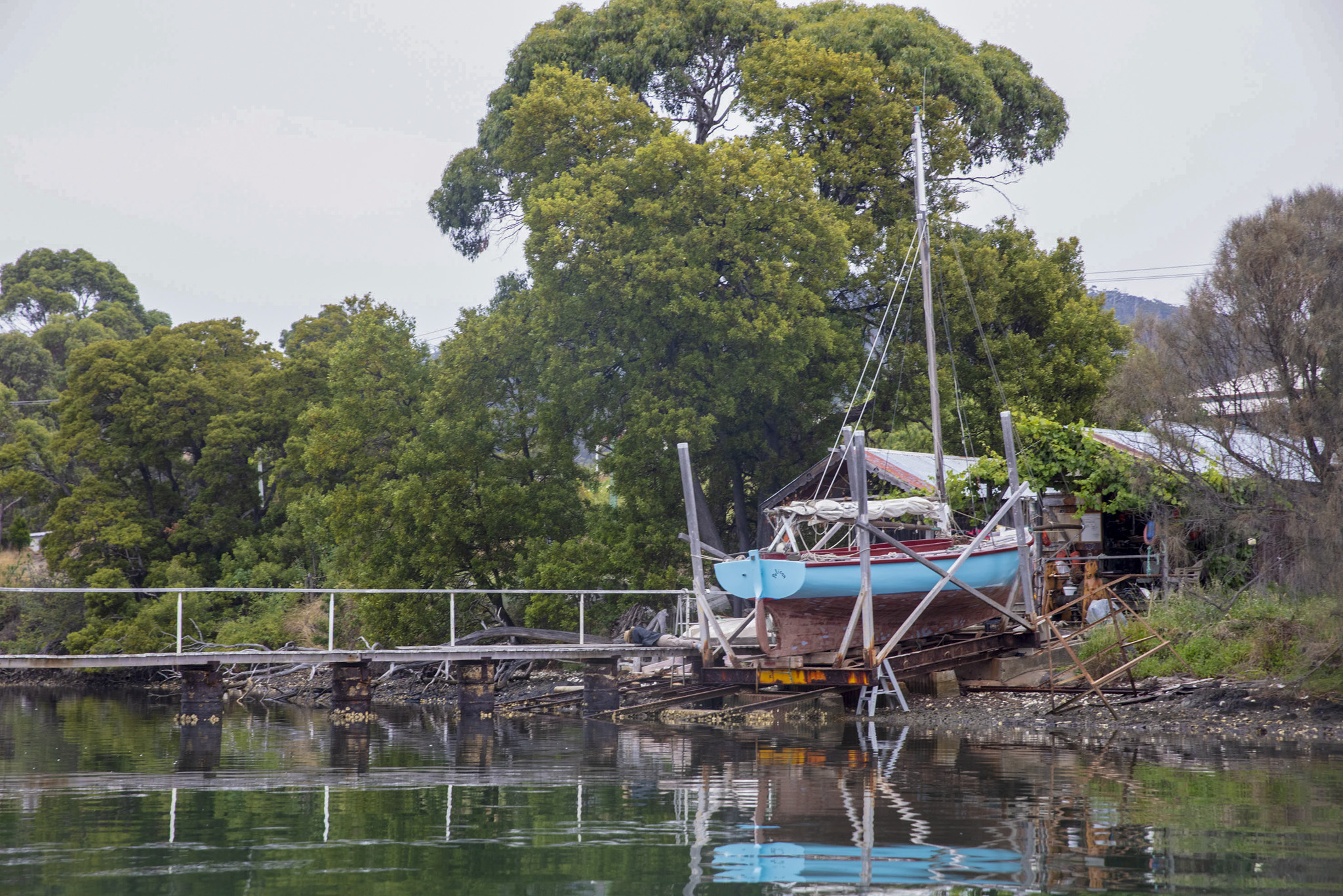
The hull was relocated in the year 2000 to David’s garage in Black Rock, Melbourne where restoration began. However, not long after he and Anastasia commenced working on the hull, they moved to Queenscliff where David became the resident shipwright at the Maritime Museum; the partially restored boat moved with them. The final stages of the restoration were completed in the yard of the Maritime Museum. All the ribs were replaced and the planking was re-fastened to the ribs, new deck timbers were fitted and an engine installed.
In 2004, the daughters of the original builder were invited to re-launch the boat in Queenscliff Harbour. Sir Francis Drake’s ship the Golden Hind was originally named Pelican. David and Anastasia reversed that name so the restored Couta Boat became Pelican.
Shortly after the re-launch, David and Anastasia decided to relocate to Southern Tasmania, and an epic voyage for Pelican was planned. She was modified with a temporary structure that covered approximately 80% of the open cockpit, and was overlayed with a purpose-built canvas cover.
Journey to Tasmania:
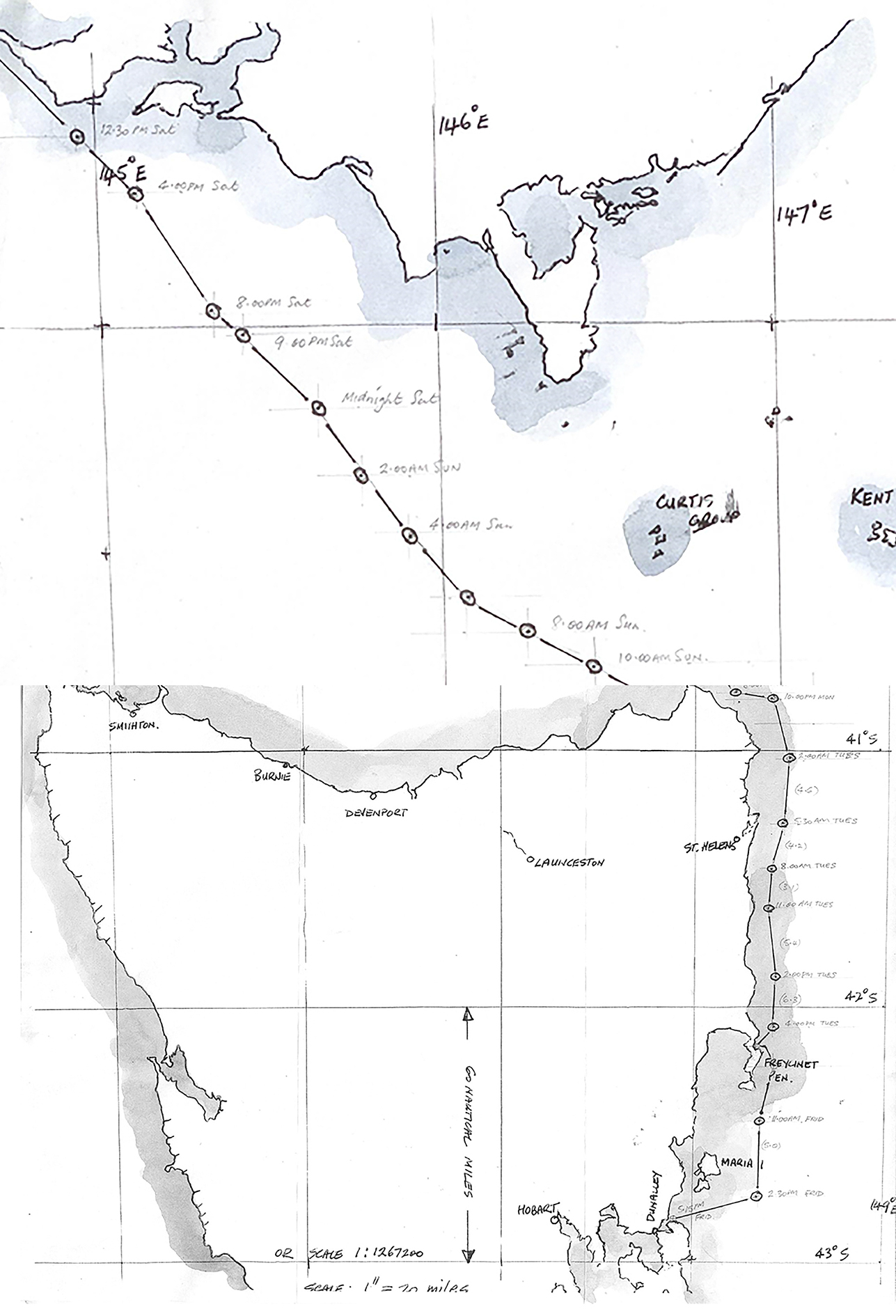
Pelican departed Queenscliff in late January, 2005, with David, Anastasia, and David’s father Michael Golding on board. In his personal account, see Appendix for the full account, Michael recalls that the journey through The Rip and into Bass Strait towards Flinders Island was sailed in favourable conditions and without hazard. However, as Pelican moved down the east coastline of Tasmania, the weather conditions worsened and so did the height of the waves.
They [waves] would surge up from behind and appear menacing from our position in the trough. The horizon would be lost and be replaced by a wave you’d be looking up at. The wave would be upon us, we would begin to surf forward, we’d momentarily see the horizon again, the back of the wave then would be in front of us, showing off its enormity, we’d then be back in the same cycle.
When conditions became inclement due to a wild storm raging across Bass Strait and down the east coast of Tasmania, Pelican and her crew sought shelter for three days in calmer waters at the southern end of Wineglass Bay. After a few days of reprieve, the journey continued down to Blackman’s Bay, through the Cut at Dunalley, into Storm Bay, into the D’Entrecasteaux Channel and on to Cygnet.
Port Cygnet:
Since her arrival in Tasmanian waters, Pelican has been moored at Port Cygnet.
She is used by Anastasia and David and their son Lewis for recreational and competitive sailing out of Port Cygnet Sailing Club. In addition, David frequently utilizes Pelican to fish in the Port Cygnet waters and the D’Entrecasteaux Channel, often returning to Port with a plentiful catch. These fishing ventures sometimes extend to Partridge Island off Bruny Island, and also southwards to Dover.
Anastasia and David have been intent in maintaining Pelican in heritage condition, wherever possible. As a professional rigger, Anastasia is responsible for the rigging. The bobstay and lifting tackle for the centre-plate are galvanised steel chain as they would have been when Pelican was a commercial fishing boat. The forestay, side stays and cap stays are all hand spliced with galvanised steel wire rope that is parcelled, served and painted. And, but not so obvious, all of the soft eyes on the side stays and gaff strop are leathered.
Since the purchase of their 54 foot ketch Kerrawyn, Anastasia and David have delegated Pelican to the responsibility of their son Lewis who sails her regularly. One of the highlights for Lewis is to sail Pelican with his friends from Cygnet up the D’Entrecasteaux Channel into the Derwent River, to Hobart for the biennial Australian Wooden Boat Festival in Hobart.
Appendix: Bass Strait Crossing in a Couta Boat by Michael Golding
This article was published in the Winter Edition (No. 62) of Watercraft Magazine 2005.
In January 2005, Anastasia Konstantinidis, and David and Michael Golding set sail in a 24 foot Couta Boat from Queenscliff at the Heads of Port Phillip in Victoria to Cygnet in southern Tasmania.
We departed 4.00 am Saturday, 29th January 2005 from Queenscliff wharf. The final days prior to our departure were taken up with numerous tasks, all in preparation for a safe journey into the southern waters. The departure was a climax for it represented a waypoint in the total adventure.
In the lead-up, I was open amongst friends and acquaintances about the proposed crossing of Bass Strait in an open boat. To my surprise, many were apprehensive about me entering into such a proposal on account of the obvious dangers. Many seafarers before us had come to grief and well-meaning friends were forthcoming in expressing their caution, but others were quite envious of my opportunity to undertake such an adventure. On balance, the prospect of having ‘done it’ was the driving force and I had no misgivings as we left the Queenscliff Harbour.
Facing up to The Rip at Port Phillip Heads was the first challenge. The sea was calm and we went out on the last of an ebb tide. We flashed the torch in the direction of the carpark next to the white lighthouse and a parked car acknowledged the contact by flashing headlights. Comforting thoughts that someone ashore was cheering us on. There was little breeze, no waves to speak of, and we continued to motor out.
Our departure line was generally central tending towards the western side of the sector. The Fisherman’s Light was visible so we pushed on in confidence. At this point we noted that a cargo ship on the horizon was approaching from the east and making towards the pick-up zone at a position three nautical miles out, to await a pilot for entry to Port Phillip. The notorious Rip was rather quiet as we passed, showing only signs of slow, swirling boils about half the size of football fields; with just a hint of what could be expected if wind, waves and current were added to its potential aggression.
About a nautical mile through The Rip, we changed course eastwards along the Point Nepean coast and looking back, we saw the pilot launch heading out to rendezvous with the cargo vessel. So far, so good!
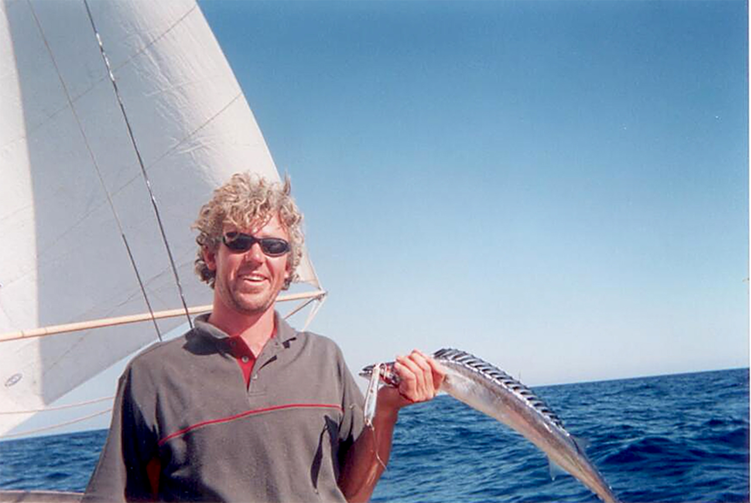
Sunrise brought a gentle southwest breeze and some rain. This reduced visibility increased our anxiety because we were in the traffic zone for cargo ships from the east approaching Port Phillip or those leaving the Heads and making their way towards Sydney and beyond. This didn’t stop David from trailing a lure, and within two minutes he caught the first of many ‘couta that those trailing lures would hook. As the ‘catch’ was hurled aboard, David proclaimed: ‘This one is for Harry.’ Harry Mouchemore had been a ‘couta fishing mentor to David for the entire three year period he spent at Queenscliff.
Our first alert to danger appeared through the rain, a cargo boat about two nautical miles ahead and approaching at 20 knots, was just six minutes away. Its line put it slightly to our Port side but we were anxious all the same. It appeared to deviate to extend the clearance and as we passed, the distance between us was approximately half a nautical mile. The ship then altered course back onto our line. It must have observed us and altered its course to give us the clearance, so we sighed with relief: first, because they saw us and, secondly, we met in daylight, albeit in conditions of poor visibility.
By this stage the wind was consistent, the motor ‘Blue Beryl’ was rested and we proceeded with the main and the No. 2 headsail. But these conditions were not to last. The wind exhausted itself and the seas put on a face of grey lead. We restarted the motor and chugged on. Anastasia and I were in the cockpit whilst David was resting below. At this moment penguins popped up their heads and a pod of dolphins was racing towards us to check us out. They were like a pack of excitable farm dogs welcoming a visitor at the front gate. David and Anastasia laid themselves prone on the foredeck and attempted to pat the playful torpedoes. But they soon lost interest in us and disappeared quietly into the depths.
Our VHF radio could pick up the Scottish voice at Tamar Sea Rescue who repeated the Bureau of Meteorology’s four day weather forecasts: South-Westerlies up to 25 knots were predicted. We had been given good advice from the fishermen at Queenscliff: ‘If the weather is good at the Prom, keep on going.’ So the decision was made.
As part of our journey plan we had an offer to sail with Denise and Chris who had departed from Paynesville in their 35 foot yacht and were waiting for us in Deal Island. However, David and Anastasia elected to forgo that offer and decided to cross Bass Strait south of Wilsons Promontory, and to sail direct to Flinders Island. The reasons were straight forward: the weather conditions were good for the course to Flinders and the extended forecast was favourable for crossing Bass Strait there and then. There was then a prediction of the weather worsening for Wednesday, three days henceforth. We were out of range to contact Denise who at that time, was waiting for us to join them at Deal Island. We believed she would understand our reasons for the revision of plans.
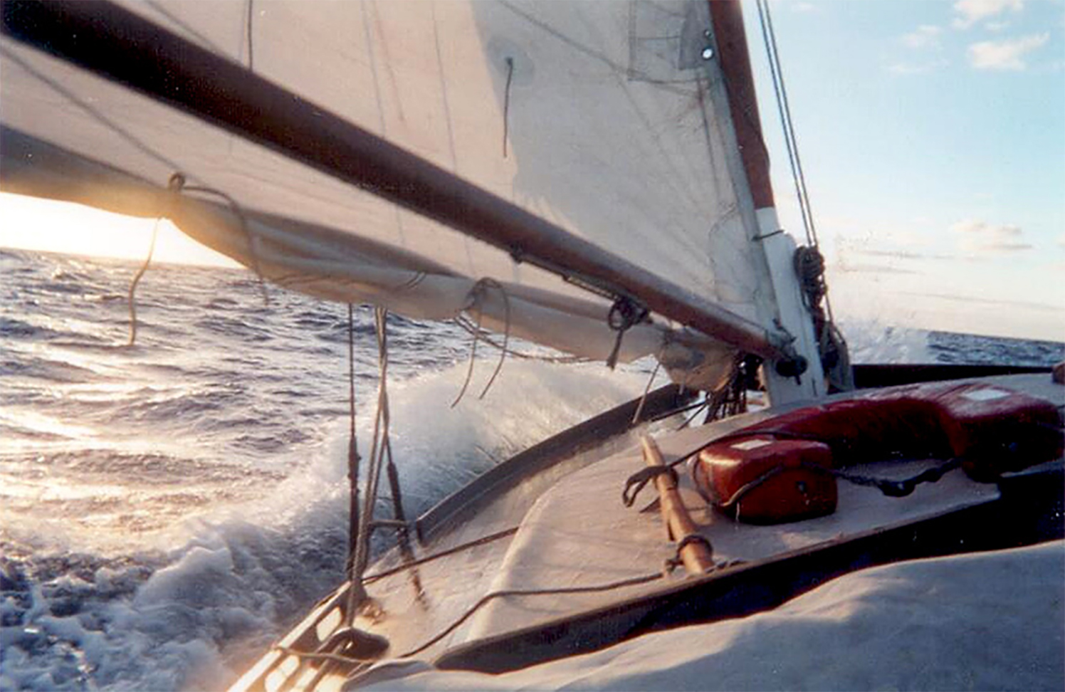
We continued on a Starboard tack, ‘reaching’ with just the mainsail up in a 15 knot SW breeze. Occasional white caps were about and the seas were no more than one metre, but building. By late afternoon David and Anastasia put a reef in the mainsail. Flinders Island was in view and we were aiming for Prime Seal Island on the west side. By sundown the wind had piped up to 25 knots and the height of the waves was around 1½ metres, but I should add that we were surging forward with the wind and waves, and hardly a splash crossed the decks in these conditions.
Throughout the twilight, the wind kept up and the point of entry to sneak in behind Prime Seal Island was generally in sight but at that stage not definite enough to be sure. The chart illustrated a safe passage but it was surrounded by foreboding rocks. We were surging into that area with the strong wind on our back; there would be little opportunity for manoeuvres should we be on an incorrect line.
The twilight vanished when we were about 1½ nautical mile off Prime Seal Island and the silhouetted island lost its definition against the black Eastern night sky. It was instantaneous, and immediately I had a feeling of dread. I wasn’t alone. David and Anastasia decided quickly that it would be unsafe to proceed and so altered course to Goose Island, a further 10 miles SE, but with a clearly defined lighthouse on the southern tip.
No longer were we with the waves; our new course had the waves coming on to us from our Starboard rear quarter. They came up to us at shoulder height as we stood at the helm but again, very little splash crossed the deck. The moon rose at about 11pm and illuminated those threatening waves which were at their worst. From down in the troughs they stood two metres above you but as they came on to us, Pelican lifted up, surfed for a short moment and then the wave was gone.
Often, bigger than usual waves came in pairs and I was somewhat prepared when a second wave broke right at my shoulder as I was sending Pelican down the wave with the breeze. I had the tiller under my chin, my feet slipped and I went down under the tiller. David, who was standing just to leeward, grabbed the tiller and kept the boat on course whilst I recovered and regained control. David went for the pump but, as it turned out, we took no more than a couple of buckets of water.
By 2 am the lighthouse was off our Port beam and we could see by moonlight the southern extent of the rocks beyond the lighthouse. We continued on for a further 300 metres to clear those rocks and to prepare ourselves to gybe. I was on the Starboard side steering whilst David was adjacent to me on the Port side, handling the mainsheet. The plan was for me to commence the turn, David would sheet in and throw the boom across, he would then take over the tiller and I would re-set the main. As events occurred, it went to plan and it wasn’t long before we rounded up behind Goose Island in calm waters. It was a relief.
Anastasia guided us to a safe mooring but it was not before she had taken three soundings to check that we were in the vicinity of the safe mooring area of the chart. Goose Island is no more than about 400 metres long and at its highest, about 5 metres above sea level, but it was more than adequate to shelter us for the remainder of the night. In our earlier approach to Prime Seal, we had radio contact with Tamar Sea Rescue who had then asked to be advised when we had made safe anchorage. We made our return call at 3am Rest at last!
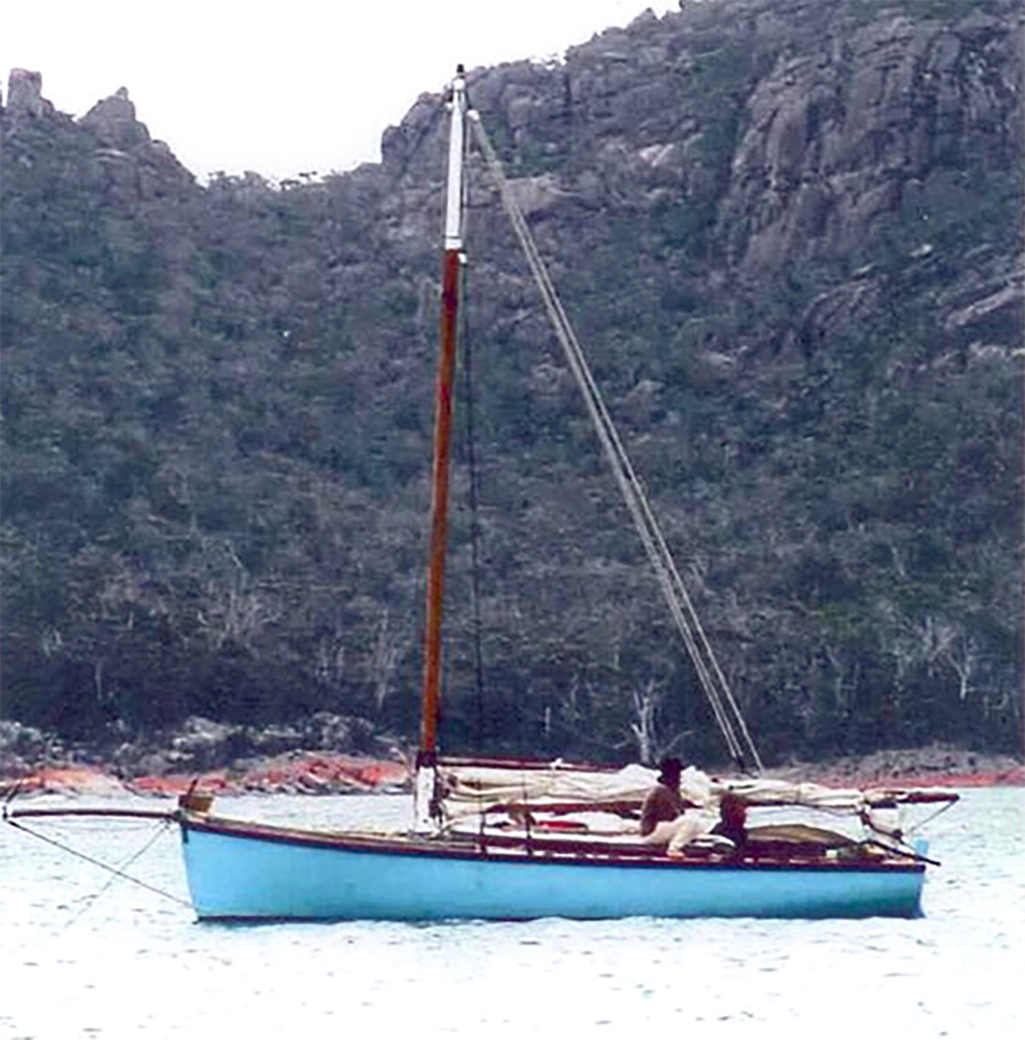
The morning light brought into focus just what a lovely anchorage we were in. There were blue skies, calm clear waters and shelter, so we relaxed. I swam about one hundred metres to the shore with the camera held high and took three photographs of the boat at anchor. David collected a few green fringe abalone, and we were refreshed and ready for the next chapter.
The plan was to depart at 11am on Monday so as to catch the tide through Banks Strait. The seas outside Goose Island had quietened and the wind had moderated to a 5 knot northerly. We made slow progress. Perhaps by now we were used to speed, but on came the ever reliable ‘Blue Beryl’ motor to keep pace so we could pass through Banks Strait. The coast of Tasmania was on our south horizon and was confirmation that we had crossed Bass Strait.
We travelled in company with a slow tug that was towing a drilling rig, which confirmed our tidal estimates that we were travelling with the current. The wind remained on our rear quarter and freshened as the day progressed. The four day forecast remained unchanged: NW to NE winds down the East coast and a change for Wednesday. Our plan was to keep travelling south as best we could whilst the northerlies lasted, and then to take shelter in Bicheno or at Wineglass Bay prior to the change.
Beyond Eddystone Lighthouse the breakers were to the shore side of our path and then we saw occasional breakers without rocks about two nautical miles ahead. Alarming! A quick consultation with the chart illustrated a reef. At this point we were about three nautical miles offshore so we altered course to stand off a further one to two nautical miles, to avoid the danger.
Despite the potential dangers, onboard we feasted well. David caught more ‘couta and, with the abalone, we dined in style, ‘though we ate with our fingers and flicked the bones into the sea.
Even though the wave conditions along the east coast were noticeably different to those in Bass Strait, David and Anastasia reefed the main and took down the jib to minimize any night-time crises. The East coast swell appeared to be gentler, if there is such an expression to describe the sea! The crest to crest length for the waves we experienced in Bass Strait was approximately 12 metres whilst waves along the East coast had a crest to crest distance of up to 50 metres. They would surge up from behind and appear menacing from our position in the trough. The horizon would be lost and be replaced by a wave you’d be looking up at. The wave would be upon us, we would begin to surf forward, we’d momentarily see the horizon again, the back of the wave would be in front of us showing off its enormity and we’d be back in the same cycle. No water came on deck and at no stage were we unnerved by these conditions.
The moon came up in the East under the boom and the conditions were just magnificent. The whooshing of the water under the lee bow in a 15 knot breeze, and the moonlight and the phosphorescent ‘fence’ around the boat made us appreciate just how good life can be.
But the sea is a ‘hungry dog’. The storm that hit southern Australia in early February 2005 was one of the biggest on record. Even the ‘Spirit of Tasmania’ ferry returned to Melbourne from mid-way through Bass Strait, due to 20 metre waves.
By dawn on Tuesday morning, the wind was developing and white caps were frequent. And by lunchtime we were experiencing a 35 knots following breeze and we were surfing. We put a second reef in the mainsail and changed the jib over to a spitfire, and took a photograph of it for Brett who had given us the jib. At one of our hourly navigational fixes, we recorded a speed of 9 knots. A fishing trawler came on us from the south and it was belting into the waves with spray obliterating our view of it, at times. The conditions were getting dangerous for us so we dropped the main entirely and sailed with only the storm jib, and I’d estimated we were still making around 4 knots. But despite the treacherous conditions building and the fact that we were running before the wind, very little spray came over the decks.
We set our course for Wineglass Bay and by 4 pm we passed the rocky outcrop at the northern end, and were heading in when the wind changed to the south. For the first time in the entire adventure we took it ‘on the nose’. The last nautical mile or so was agonizingly slow but we maintained control. Occasional mats of kelp were around and frequently became enmeshed with the propeller. In these instances, the motor would be sluggish with black smoke enveloping us, so David would put us momentarily into reverse, the kelp would then release and we’d be back in control.
As had four other yachts, we selected the southern end of Wineglass Bay to anchor in sheltered waters for the night. An unnerving sight of a sunken sixth yacht in the same area brought to bear the perils of extended sailing. I slept out under the cover in the cockpit and even though it rained, water ran off the cover away from me, so I remained dry. Whilst the rain did not affect our living conditions, the mosquitoes did and one bit me on the eyelid, which caused the predictable swelling that closed my eye for a couple of hours. The rain settled in and confined us to the covered section. There was nothing to do but sleep or eat.
By early afternoon, I’d had enough and decided to swim to shore with my clothes packed into a plastic bag so that they remained dry. On shore I then went up the walking track of the National Park, and coming down the track were two walkers with what appeared to be their house on their backs. We swapped pleasantries and they asked where I’d come from? To their astonishment I responded: ‘I just swam ashore!’
Back in the bay, the salvage team from the ‘Vanessa D’ was proceeding to pull apart the sunken wooden yacht Ciest La Vie. It was sad to witness. Along the beach, I introduced myself to the leader of the salvage team. ‘Hello, I’m Mike’. His response was, ‘I’m Tony and you don’t want to know me. People only get to meet me when tragedy strikes.’ He was right! I have since erased my memory of Tony.
The storm raged on. Storm warnings were about all Tasmanian waters. The wind was so fierce that it would have blown the numbers off the sails if they’d been up. I took another walk up the track and looked out beyond the protection of the bay to where the waves were fiercely furious.
We continued to monitor Hobart Coast Radio for their regular weather forecasts and when the invitation for position reports came on, Even Stevens, a fishing trawler moored adjacent to Pelican and with a more powerful radio transmitter, reported that we were sheltering in Wineglass Bay.
By the next morning, the storm had diminished and the forecast was for NE winds; it was a perfect breeze. With the motor on, we crept out of our safe haven of the past three nights and stood off about a nautical mile before setting sail southwards. We had a 10 knot following breeze that increased to no more than 20 knots while the following swell was no more than 3 metres.
We quietly slid past Freycinet Peninsula and Shouten Island as we headed south. Fisherman Rod had recommended we pass through Shouten passage, enter Oyster Bay and aim for Mercury passage behind Maria Island to get to Blackman Bay. I’ve heard it said that there are two types of navigators: Those that get scared when they see land and those that get scared when they can’t. I think we fit into the first category, and so our course from Wineglass Bay was seaward of Shouten and Maria Islands.
By early afternoon, we were approximately 20 nautical miles off Marion Bay when we gybed onto Starboard and made for Bateman Bay. By 4 pm we had entered the Channel and were following the markers, we had the wind behind us and were travelling with the flooding tide in calm waters and making good progress. There were farms to the left and farms to the right: signs that we were in close company with civilization again. We glided up to the pier at Dunalley to an unexpected welcome. One bloke took our rope and we secured ourselves to the lee side of a fishing boat owned by Bill.
Locals, Tim and Tammy, had seen us come up the channel from their property and drove driven down to invite us back to their home for dinner. That evening we sat around their table until midnight with their neighbours and aired plenty of views about a range of opinions on art, science and philosophy. The dinner was delicious. More delicious was the fact that David, Anastasia and I had a cottage to ourselves, with the luxury of a soft bed, a hot shower and a flush toilet! All of this was on account of sailing an iconic heritage boat and a chance-meeting with hospitable people.
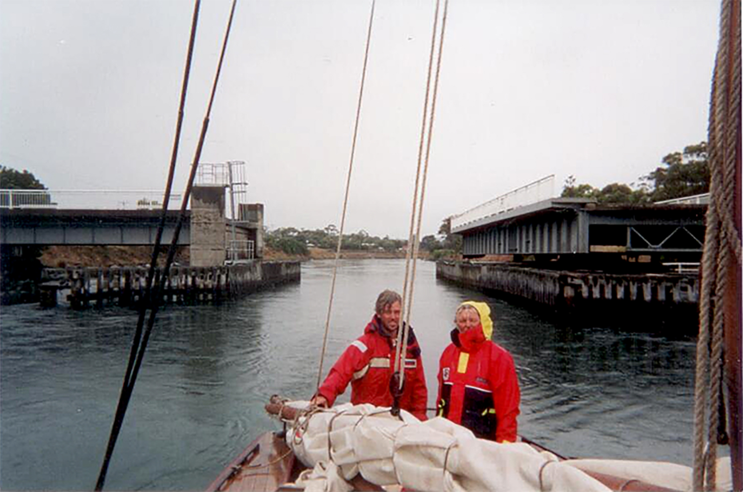
The next day brought intermittent showers but little breeze. We radioed on and the bridge at the Denison Canal, known as The Cut, was opened for us. We paid our dues of a gold coin and the obligatory can of beer and motored through. But the gentle breeze was slightly against us so we tacked our way to Green Head with the assistance of ‘Blue Beryl’. We passed inside of Betsey Island, came around the distinctive Iron Pot buoy and entered D’Entrecasteaux Channel behind North Bruny Island and continued on to Cygnet where we tied up at the shipwright’s jetty at 10 pm.
Our arrival so late in the evening was somewhat of an anti-climax. In that moment it was not possible to process all the moments of anxiety, danger and, even terror; as well as the many moments of wonder, even awe, that we experienced. Despite the terrifying moments, the journey was a life-changing experience and will stay with me for the rest of my life.
Michael Golding
February 2005